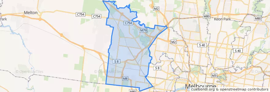
Oturum aç
Yıldız kullanıcılar
Anket
anasayfa
>
Avustralya
>
Victoria
>
City of Brimbank
City Of Brimbank
Etkileşimli haritada görüntüle
Toplu taşıma yolları
Bus 216: City (Queen Street) => Dynon Road => Sunshine Station
Bus 216: Sunshine Station => Dynon Road => City (Queen Street)
Bus 220: City (Queen Street) => Footscray Road => Sunshine Station
Bus 220: Sunshine Station => Footscray Road => City (Queen Street)
Bus 400: Laverton Station => Robinsons Road => Sunshine Station
Bus 400: Sunshine Station => Robinsons Road => Laverton Station
Bus 408: Highpoint Shopping Centre => Sunshine Station => St Albans Station
Bus 408: St Albans Station => Sunshine Station => Highpoint Shopping Centre
Bus 418: Caroline Springs => Keilor Plains Station => St Albans Station
Bus 418: St Albans Station => Keilor Plains Station => Caroline Springs
Bus 419: St Albans Station => Keilor Downs => Watergardens Station
Bus 419: Watergardens Station => Keilor Downs => St Albans Station
Bus 421: St Albans Station => Keilor Plains Station => Watergardens Station
Bus 421: Watergardens Station => Keilor Plains Station => St Albans Station
Bus 425: St Albans Station => Delahey => Watergardens Station
Bus 425: Watergardens Station => Delahey => St Albans Station
Bus 426: Caroline Springs => Sunshine Station
Bus 426: Sunshine Station => Caroline Springs
Bus 429: Sunshine Station => Sunshine South => Sunshine Station
Bus 463: Hillside => Langmore Drive => Watergardens Station
Bus 463: Watergardens Station => Langmore Drive => Hillside
Bus 469: Keilor East => Strathmore => Moonee Ponds
Bus 469: Moonee Ponds => Strathmore => Keilor East
Bus 471: Sunshine => Altona Gate SC & Newport => Williamstown
Bus 471: Williamstown => Newport & Altona Gate SC => Sunshine
Bus 476: Moonee Ponds => Watergardens
Bus 476: Watergardens => Moonee Ponds
Bus 477: Broadmeadows Station => Gladstone Park & Airport West & Essendon => Moonee Ponds
Bus 477: Moonee Ponds => Essendon & Airport West & Gladstone Park => Broadmeadows Station
Bus 478: Airport West Shopping Centre => Melrose Drive => Melbourne Airport
Bus 479: Airport West Shopping Centre => Melbourne Airport => Sunbury Station
Bus 482: Airport West Shopping Centre => South Centre Road => Melbourne Airport
Bus 482: Melbourne Airport => South Centre Road => Airport West Shopping Centre
Bus 902: Airport West Shopping Centre => Chelsea railway station
Bus 903: Altona railway station → Mordialloc Shopping Centre
Bus 903: Mordialloc Shopping Centre → Altona railway station
Durur
Nordic Avenue/Wellesley Drive
Spence Street/Fosters Road
Burrowye Crescent/Old Calder Highway
Fastnet Drive/Parmelia Drive
144.77987430000002, -37.6855518
Swan Street/Fosters Road
Lionheart Avenue/Parmelia Drive
144.7774362, -37.687344100000004
Rutherglen Way/Sunshine Avenue
Koroit Place/Apollo Road
Pindari Avenue/Apollo Road
Barwon Avenue/Patterson Avenue
Mary MacKillop Primary School/Sunshine Avenue
Barwon Avenue/Patterson Avenue
Wanaka Drive/Sunshine Avenue
Swan Street/Erebus Street
Chichester Drive/Apollo Road
Campaspe Crescent/Patterson Avenue
144.7772739, -37.6873462
144.7643945, -37.7927235
Newell Close/Wellesley Drive
Lawson Court/Wellesley Drive
Keilor Shopping Centre/Old Calder Highway
Chichester Drive/Parmelia Drive
Petrik Drive/Old Calder Highway
Campaspe Crescent/Patterson Avenue
Sunshine Station (Bay 3)
Sydenham Reserve/Robertsons Road
Keilor Retirement Village/Old Calder Highway
Spence Street/Erebus Street
İlgi noktaları
Caltex
United
Sunshine City Club
Lasang Pinoy
Yoyo
Albion Kindergarten
McDonald's
Carbone's Cafe
TT Hotpot
Karibu African Coffee Club
Kore Wellness & Swim Centre
Inside Centre
Commonwealth Bank
Commonwealth Bank
White Hill Cafe
Rowena
Akira
Sunshine Library
Panic Pizza
Dental Surgery
Ames
Cernavin Dental Clinic
Pharmasave
Dr Paws Vet
Marty'a
T.C. Cafe
Village Cinemas
Jucy
The Old Keilor Hotel
MyKi