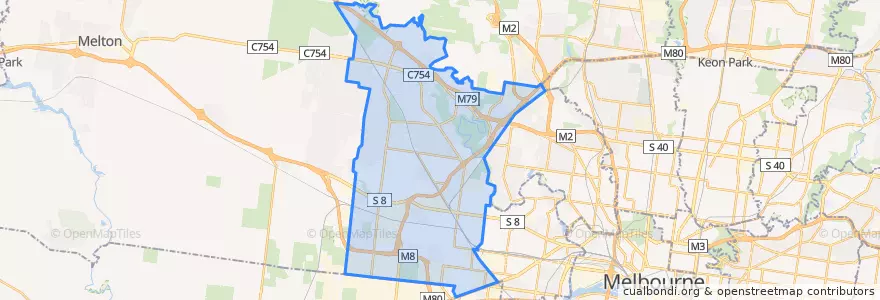
Accesso
Utenti preferiti
Sondaggio
Homepage
>
Australia
>
Victoria
>
City of Brimbank
City Of Brimbank
Visualizza nella mappa interattiva
Percorsi di trasporto pubblico
Bus 216: City (Queen Street) => Dynon Road => Sunshine Station
Bus 216: Sunshine Station => Dynon Road => City (Queen Street)
Bus 220: City (Queen Street) => Footscray Road => Sunshine Station
Bus 220: Sunshine Station => Footscray Road => City (Queen Street)
Bus 400: Laverton Station => Robinsons Road => Sunshine Station
Bus 400: Sunshine Station => Robinsons Road => Laverton Station
Bus 408: Highpoint Shopping Centre => Sunshine Station => St Albans Station
Bus 408: St Albans Station => Sunshine Station => Highpoint Shopping Centre
Bus 418: Caroline Springs => Keilor Plains Station => St Albans Station
Bus 418: St Albans Station => Keilor Plains Station => Caroline Springs
Bus 419: St Albans Station => Keilor Downs => Watergardens Station
Bus 419: Watergardens Station => Keilor Downs => St Albans Station
Bus 421: St Albans Station => Keilor Plains Station => Watergardens Station
Bus 421: Watergardens Station => Keilor Plains Station => St Albans Station
Bus 425: St Albans Station => Delahey => Watergardens Station
Bus 425: Watergardens Station => Delahey => St Albans Station
Bus 426: Caroline Springs => Sunshine Station
Bus 426: Sunshine Station => Caroline Springs
Bus 429: Sunshine Station => Sunshine South => Sunshine Station
Bus 463: Hillside => Langmore Drive => Watergardens Station
Bus 463: Watergardens Station => Langmore Drive => Hillside
Bus 469: Keilor East => Strathmore => Moonee Ponds
Bus 469: Moonee Ponds => Strathmore => Keilor East
Bus 471: Sunshine => Altona Gate SC & Newport => Williamstown
Bus 471: Williamstown => Newport & Altona Gate SC => Sunshine
Bus 476: Moonee Ponds => Watergardens
Bus 476: Watergardens => Moonee Ponds
Bus 477: Broadmeadows Station => Gladstone Park & Airport West & Essendon => Moonee Ponds
Bus 477: Moonee Ponds => Essendon & Airport West & Gladstone Park => Broadmeadows Station
Bus 478: Airport West Shopping Centre => Melrose Drive => Melbourne Airport
Bus 479: Airport West Shopping Centre => Melbourne Airport => Sunbury Station
Bus 482: Airport West Shopping Centre => South Centre Road => Melbourne Airport
Bus 482: Melbourne Airport => South Centre Road => Airport West Shopping Centre
Bus 902: Airport West Shopping Centre => Chelsea railway station
Bus 903: Altona railway station → Mordialloc Shopping Centre
Bus 903: Mordialloc Shopping Centre → Altona railway station
Fermate
Swan Street/Fosters Road
Mary MacKillop Primary School/Sunshine Avenue
Chichester Drive/Parmelia Drive
Flora Street/Old Calder Highway
144.75994740000002, -37.7889527
Nordic Avenue/Wellesley Drive
Reed Crescent/Bond Drive (East)
Sunshine Station (Bay 13)
Lawson Court/Wellesley Drive
Sunshine Station (Bay 3)
Rutherglen Way/Sunshine Avenue
Swan Street/Erebus Street
Spence Street/Fosters Road
144.7902225, -37.7708547
Watergardens Shopping Centre/Watergardens Circuit Road
Barwon Avenue/Patterson Avenue
Fastnet Drive/Parmelia Drive
Loddon Avenue/Patterson Avenue
Pindari Avenue/Apollo Road
Keilor Shopping Centre/Old Calder Highway
Keilor Retirement Village/Old Calder Highway
Messina Crescent/Verona Drive
Swan Street/Fosters Road
Spence Street/Erebus Street
Burrowye Crescent/Old Calder Highway
Collinson Street/Spence Street
Banksia Grove/Sharps Road
Tambo Court/Green Gully Road
Watergardens Station/Watergardens Circuit Road (Bay 2)
Swan Street/Erebus Street
Punti di interesse
Thy’s Sandwiches
McDonald's
Ozi's Cafe
Caffe Dolce
Sydenham Maternal And child Health Centre
Afghan Master Kebab Grill
Akira
Grill'd
Just Vegan
White Hill Cafe
The Granary Cafe
Aangan Derrimut
Caltex
Alfrieda St Pharmacy
Rock N Roll Charcoacl Chicken
Village Cinemas
Da Lat Hill
Priceline Pharmacy
Ramciel
Terrywhite Chemist
T.C. Cafe
Commonwealth Bank
Hoyts
Sumos Noodle & Sushi Bar
Dr Paws Vet
Advance Healthcare
New Favorite Chinese Seafood
Overnewton Castle
Albion Kindergarten
Kore Wellness & Swim Centre