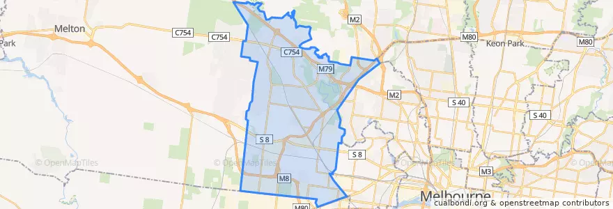
Log masuk
Pengguna bintang
Undian
Laman utama
>
Australia
>
Victoria
>
City of Brimbank
City Of Brimbank
Lihat di peta interaktif
Laluan pengangkutan awam
Bus 216: City (Queen Street) => Dynon Road => Sunshine Station
Bus 216: Sunshine Station => Dynon Road => City (Queen Street)
Bus 220: City (Queen Street) => Footscray Road => Sunshine Station
Bus 220: Sunshine Station => Footscray Road => City (Queen Street)
Bus 400: Laverton Station => Robinsons Road => Sunshine Station
Bus 400: Sunshine Station => Robinsons Road => Laverton Station
Bus 408: Highpoint Shopping Centre => Sunshine Station => St Albans Station
Bus 408: St Albans Station => Sunshine Station => Highpoint Shopping Centre
Bus 418: Caroline Springs => Keilor Plains Station => St Albans Station
Bus 418: St Albans Station => Keilor Plains Station => Caroline Springs
Bus 419: St Albans Station => Keilor Downs => Watergardens Station
Bus 419: Watergardens Station => Keilor Downs => St Albans Station
Bus 421: St Albans Station => Keilor Plains Station => Watergardens Station
Bus 421: Watergardens Station => Keilor Plains Station => St Albans Station
Bus 425: St Albans Station => Delahey => Watergardens Station
Bus 425: Watergardens Station => Delahey => St Albans Station
Bus 426: Caroline Springs => Sunshine Station
Bus 426: Sunshine Station => Caroline Springs
Bus 429: Sunshine Station => Sunshine South => Sunshine Station
Bus 463: Hillside => Langmore Drive => Watergardens Station
Bus 463: Watergardens Station => Langmore Drive => Hillside
Bus 469: Keilor East => Strathmore => Moonee Ponds
Bus 469: Moonee Ponds => Strathmore => Keilor East
Bus 471: Sunshine => Altona Gate SC & Newport => Williamstown
Bus 471: Williamstown => Newport & Altona Gate SC => Sunshine
Bus 476: Moonee Ponds => Watergardens
Bus 476: Watergardens => Moonee Ponds
Bus 477: Broadmeadows Station => Gladstone Park & Airport West & Essendon => Moonee Ponds
Bus 477: Moonee Ponds => Essendon & Airport West & Gladstone Park => Broadmeadows Station
Bus 478: Airport West Shopping Centre => Melrose Drive => Melbourne Airport
Bus 479: Airport West Shopping Centre => Melbourne Airport => Sunbury Station
Bus 482: Airport West Shopping Centre => South Centre Road => Melbourne Airport
Bus 482: Melbourne Airport => South Centre Road => Airport West Shopping Centre
Bus 902: Airport West Shopping Centre => Chelsea railway station
Bus 903: Altona railway station → Mordialloc Shopping Centre
Bus 903: Mordialloc Shopping Centre → Altona railway station
Perhentian
Verona Drive/Melton Highway
St Albans Station (Bay 3)
Watergardens Shopping Centre / Melton Highway
144.75994740000002, -37.7889527
Watergardens Station/Watergardens Circuit Road (Bay 1)
Spence Street/Fosters Road
Augustines Way/Old Calder Highway
Petrik Drive/Old Calder Highway
Tambo Court/Green Gully Road
144.7902225, -37.7708547
Sunshine Station (Bay 1)
Sunshine Station (Bay 3)
Banksia Grove/Sharps Road
144.7772739, -37.6873462
Chichester Drive/Parmelia Drive
Wanaka Drive/Sunshine Avenue
Flora Street/Old Calder Highway
Swan Street/Fosters Road
Spence Street/Erebus Street
Sunshine Station (Bay 4)
Lionheart Avenue/Parmelia Drive
144.7643945, -37.7927235
Borrell Street/Old Calder Highway
Keilor Shopping Centre/Old Calder Highway
Sunshine Station (Bay 6)
St Albans Station (Bay 2)
Flora Street/Old Calder Highway
Loddon Avenue/Patterson Avenue
Swan Street/Erebus Street
Sunshine Station (Bay 7)
Tempat menarik
BOM
Salt and Pepper House
Sushi Sushi
Carbone's Cafe
St Albans Station
Latin Foods & Wines
McDonald's
Caltex
TT Hotpot
Boost Juice
Taylors Lakes Chinese Restaurant
iCafe
Song Huong
Sydenham Maternal And child Health Centre
Keilor Downs Surgery
Keilor LPO
West Turk House & Elderly
McDonald's
Grill'd
7-Eleven
IPC Health Inc.
Sunshine City Club
Caltex
Sunshine Smiles Dental Clinic
Priceline Pharmacy
Red Rooster
Lakeside Banquet & Convention Centre
Dr Paws Vet
Shisha Cafe
Phở Hiền