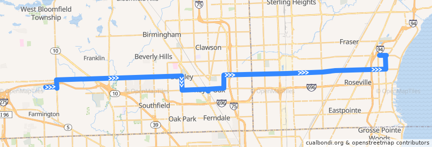
Route 740 EB: Oakland CC => Roseville
Places that travel to
Points of interest near the route
Stops:
- -82.9224925, 42.5099378
- -83.18798290000001, 42.5031508
- -83.3165841, 42.5003274
- -83.1699371, 42.4891352
- -83.2447389, 42.5018867
- 12 Mile / Dartmouth (EB)
- -83.0718069, 42.5056067
- -82.96784240000001, 42.508874500000005
- -83.18367020000001, 42.4963095
- 11 Mile / Vermont NS (EB)
- -83.1395184, 42.4899471
- 12 Mile / Delton (EB)
- -83.3126682, 42.500441900000006
- Oakland / Orchard Lake NS (EB)
- -82.9741357, 42.508485900000004
- -83.297739, 42.500817000000005
- 12 Mile / Milton (EB)
- -83.1413648, 42.489908500000006
- 12 Mile / Heritage (EB)
- -82.89803090000001, 42.52489
- 12 Mile / Howard (EB)
- 12 Mile / GM Farside Mound (EB)
- -82.9595017, 42.509058
- -83.0227433, 42.506678900000004
- 12 Mile / Fairfax (EB)
- -83.2253625, 42.5023709
- 12 Mile / Imperial (EB)
- -82.9053909, 42.510272900000004
- 12 Mile / Park NS (EB)
- -82.9400337, 42.5095551
- -83.3538999, 42.4993696
- 12 Mile / Gail (EB)
- -83.18354760000001, 42.4932585
- -83.0641164, 42.505785800000005
- -83.1189263, 42.504416600000006
- 12 Mile / Sutherland (EB)
- 12 Mile / Franklin River (EB)
- 12 Mile / Rock Creek (EB)
- -83.05687680000001, 42.505948000000004
- -83.1108746, 42.5046079
- -82.92512710000001, 42.509888700000005
- -83.1663377, 42.4892332
- -82.93791010000001, 42.509607200000005
- 12 Mile / Griffith (EB)
- 12 Mile / Gratiot (EB)
- 11 Mile / Farmer's Market (EB)
- Campbell / Gardenia (NB)
- 12 Mile / Macomb Community College (EB)
- -83.1244492, 42.490960300000005
- 12 Mile / Bunert (EB)
- -83.0458742, 42.5061235
- Harper / 12 Mile (NB)
- 12 Mile / Thomas (EB)
- 12 Mile / Cumberland (EB)
- -83.1285514, 42.4902608
- -82.9321542, 42.509725800000005
- -83.1245655, 42.5043394
- 12 Mile / Hoover (EB)
- -83.35825510000001, 42.4992278
- -82.98295540000001, 42.507931500000005