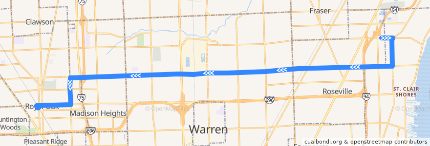
Route 740 WB: Roseville => Royal Oak
Places that travel to
Points of interest near the route
Stops:
- 12 Mile / Schoenherr (WB)
- -82.9529682, 42.509219
- -82.9151918, 42.5100866
- -83.0360462, 42.506296000000006
- 12 Mile / Longview (WB)
- -82.9291393, 42.509797000000006
- -82.9258562, 42.5098715
- 12 Mile / Lorna (WB)
- Harper / Francis NS (SB)
- -82.9118389, 42.5101348
- -82.8986105, 42.5169675
- 11 Mile / Campbell (WB)
- -82.9690929, 42.5088109
- -82.99241710000001, 42.5074963
- 12 Mile / Senator (WB)
- -83.13308330000001, 42.490138900000005
- 12 Mile / Mound (WB)
- 12 Mile / Little Mack (WB)
- 12 Mile / Herbert (WB)
- Campbell / 12 Mile (SB)
- -82.94301730000001, 42.509476500000005
- -83.12496730000001, 42.5034782
- -83.0294861, 42.506653500000006
- -82.9594105, 42.509060600000005
- -83.02230250000001, 42.506686800000004
- 12 Mile / Lorraine (WB)
- -83.12467570000001, 42.4962705
- -83.01437960000001, 42.5068799
- -83.1474025, 42.4884514
- -82.8991896, 42.5104077
- -83.07197830000001, 42.5056026
- -82.89818310000001, 42.5241613
- 12 Mile / Groesbeck NS (WB)
- -83.125045, 42.4903512
- -82.98777700000001, 42.5076375
- 12 Mile / Merrick (WB)
- -82.97816420000001, 42.508236700000005
- -83.0866599, 42.5051883
- 12 Mile / Wagner (WB)
- 12 Mile / Fountain View Apartments (WB)
- Harper / 13 Mile (SB)
- 12 Mile / Hoover NS (WB)
- -83.0812585, 42.505337000000004
- -82.919623, 42.5100051
- -82.99552920000001, 42.5073944
- -82.8988216, 42.5219649
- Campbell / University (SB)
- 11 Mile / Vermont (WB)
- 12 Mile / Panama (WB)
- 12 Mile / Macomb Community College (WB)
- Harper / Jewell (SB)
- -82.9640998, 42.508945700000005
- 12 Mile / John R (WB)
- 12 Mile / Rymal (WB)
- -83.1039547, 42.504786200000005
- 12 Mile / Van Dyke (WB)
- -83.0523814, 42.5060621
- 12 Mile / Utica (WB)
- 12 Mile / Red Maple (WB)
- -83.0645903, 42.505772