Login
Star users
Poll
Home
>
Baltimore
>
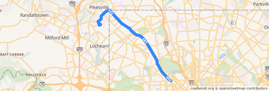
LocalLink 85: Milford Mill
Route
LocalLink 85: Milford Mill
write the first review
See in interactive map
Points of interest near the route
Zera Israel Synagogue
The Maryland Church of God in Christ School
Chofetz Chaim Synagogue
New Life Inspirational Church
Shaarei Tzedek Synagogue
Womens Institute of Torah Seminary
Druid Hill Farmers Market
New York Fried Chicken
Park Heights Baptist Temple
Christian Baptist Church
Orchard Park Christian Jubilee Church
Beth Jacob School
Suburban Orthodox Congregation
Kingdom Hall of Jehovahs Witnesses
First Baptist Church
Sudbrook Methodist Church
Ray's Temple Apostolic Faith Church
Berean Baptist Church
Rogers Avenue Synagogue
The Maryland Church of God in Christ
Elgin Head Start Center
Park Heights Avenue Academy
Bethel Missionary Baptist Church
New Fellowship Christian Community Church
Bethel Pentecostal Church
United Bible Way Church
Gethsemane Baptist Church
Colonial Church
Miracle Deliverance Center
Simmons Memorial Baptist Church
Bible Fellowship Chapel
Shearith Israel Synagogue
Kiddie Castle Child Development
Arlington Presbyterian Church
Saint John Baptist Church
Bnos Yisoel School
Douglas Frederick Early Learning Center
Baltimore Hebrew University
The Obedience Church of God
Wilton Heights Methodist Protestant Church
Islamic Community School
Assembly Praise Convent
Churches of International Fellowship
Shaarei Zion Religious Center
Good Shepherd Baptist Church
The Lord's Church
Stops:
Reisterstown Road & Liberty Heights Avenue Northbound
Park Heights Avenue & Belvedere Avenue Far-side Northbound
Park Heights Avenue & Rogers Avenue Northbound
Reisterstown Road & Ruskin Avenue Northbound
Reisterstown Road & Chowan Avenue Opposite Northbound
-76.6681274, 39.3417903
Reisterstown Road & Chowan Avenue Opposite Northbound
Park Heights Avenue & Hayward Avenue Northbound
Park Heights Avenue & Garrison Avenue Northbound
Park Heights Avenue & Belvedere Avenue Far-side Northbound
Park Heights Avenue & Taney Road Northbound
Park Heights Avenue & Garrison Avenue Northbound
Park Heights Avenue & Glen Avenue Northbound
Park Heights Avenue & Quantico Avenue Northbound
Park Heights Avenue & Springhill Avenue Northbound
Park Heights Avenue & Shirley Avenue Northbound
Pennsylvania Avenue & Fulton Avenue Northbound
Park Heights Avenue & Keyworth Avenue Far-side Northbound
Reisterstown Road & Liberty Heights Avenue Northbound
Park Heights Avenue & Northern Parkway Northbound
Park Heights Avenue & Taney Road Northbound
Milford Mill
Reisterstown Road & Ocala Avenue Northbound
Park Heights Avenue & Violet Avenue Northbound
Reisterstown Road & Ruskin Avenue Northbound
Park Heights Avenue & Hilldale Avenue Far-side Northbound
Pennsylvania Avenue & Fulton Avenue Northbound
Park Heights Avenue & Shirley Avenue Northbound
Park Heights Avenue & Druid Park Drive Far-side Northbound
Park Heights Avenue & Menlo Drive Northbound
Park Heights Avenue & Hayward Avenue Northbound
North Avenue & Pennsylvania Avenue Westbound
Park Heights Avenue & Wylie Avenue Northbound
Park Heights Avenue & Menlo Drive Northbound
Reisterstown Road & Fulton Avenue
Pennsylvania Avenue & Clifton Avenue Northbound
-76.6673602, 39.340941300000004
Reisterstown Road & Ocala Avenue Northbound
Pennsylvania Avenue & Clifton Avenue Northbound
Reisterstown Road & Druid Park Drive Northbound
Park Heights Avenue & Trainor Avenue Northbound
Park Heights Avenue & Quantico Avenue Northbound
Park Heights Avenue & Rogers Avenue Northbound
Park Heights Avenue & Springhill Avenue Northbound
Park Heights Avenue & Keyworth Avenue Far-side Northbound
North Avenue & Pennsylvania Avenue Westbound
Park Heights Avenue & Hilldale Avenue Far-side Northbound
Park Heights Avenue & Violet Avenue Northbound
Reisterstown Road & Druid Park Drive Northbound
Park Heights Avenue & Trainor Avenue Northbound
Park Heights Avenue & Druid Park Drive Far-side Northbound
Park Heights Avenue & Northern Parkway Northbound
Reisterstown Road & Fulton Avenue
Park Heights Avenue & Sumter Avenue Northbound